
Thank you for supporting this site ❤️
Make a donation
Make a donation
Gear up for your next adventure:
As an Amazon Associate, this site earns from qualifying purchases at no extra cost to you.
Artesonraju topographic map
Click on the map to display elevation.
Thank you for supporting this site ❤️
Make a donation
Make a donation
Gear up for your next adventure:
As an Amazon Associate, this site earns from qualifying purchases at no extra cost to you.
About this map
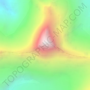
Name: Artesonraju topographic map, elevation, terrain.
Location: Artesonraju, Santa Cruz, Province of Huaylas, Ancash, Peru (-8.95216 -77.63280 -8.95206 -77.63270)
Average elevation: 16,857 ft
Minimum elevation: 14,764 ft
Maximum elevation: 19,541 ft
Thank you for supporting this site ❤️
Make a donation
Make a donation
Gear up for your next adventure:
As an Amazon Associate, this site earns from qualifying purchases at no extra cost to you.