Geolocate

Deha topographic map

Click on the map to display elevation.

About this map

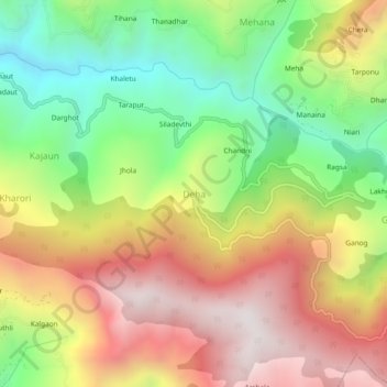
Name: Deha topographic map, elevation, terrain.

Location: Deha, Theog, Shimla, Himachal Pradesh, India (31.02382 77.43489 31.06382 77.47489)

Average elevation: 6,719 ft

Minimum elevation: 4,760 ft

Maximum elevation: 8,812 ft

Gear up for your next adventure:

🧭Compass with Lanyard - Easy‑carry compass for navigation
🍳Camping Cook Set - Complete cookware for outdoor meals
🧭Map Reading Tools - Tools and kits for map navigation
🧭Hiking Compass - Precision compass for reliable navigation in the wilderness
📷Action Cameras - Rugged cameras to document your journeys across rugged terrain

As an Amazon Associate, this site earns from qualifying purchases at no extra cost to you.