Geolocate

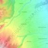
Magtuod topographic map

Click on the map to display elevation.

About this map

Name: Magtuod topographic map, elevation, terrain.

Location: Magtuod, Davao City, Buhangin District, Davao Region, 8000, Philippines (7.10272 125.54573 7.14272 125.58573)

Average elevation: 308 ft

Minimum elevation: 7 ft

Maximum elevation: 741 ft

Other topographic maps

Click on a map to view its topography, its elevation and its terrain.
Matina Pangi

Philippines > Davao City

Average elevation: 174 ft

Tamayong

Philippines > Davao City

Average elevation: 2,552 ft

75-A Matina Aplaya

Philippines > Davao City

Average elevation: 10 ft

Baguio District

Philippines > Davao City

Average elevation: 1,847 ft

Lipadas River

Philippines > Davao City

Average elevation: 4,432 ft

26-C Silangan

Philippines > Davao City

Average elevation: 13 ft

Matina River

Philippines > Davao City > Matina Pangi

Average elevation: 203 ft

Ma-a

Philippines > Davao City

Average elevation: 118 ft

Gear up for your next adventure:

🧭GPS Watch Accessories - Bands and chargers for GPS watches
🛡️Bear Spray Outdoor - Protection in bear country hikes
🔌USB Car Charger - Car charger for on‑the‑go power needs
🪶Wildlife Field Guides - Learn animal tracking and species ID
💧Water Purification System - Clean water on the trail with reliable purifiers

As an Amazon Associate, this site earns from qualifying purchases at no extra cost to you.