
Thank you for supporting this site ❤️
Make a donation
Make a donation
Gear up for your next adventure:
As an Amazon Associate, this site earns from qualifying purchases at no extra cost to you.
Penedo topographic map
Click on the map to display elevation.
Thank you for supporting this site ❤️
Make a donation
Make a donation
Gear up for your next adventure:
As an Amazon Associate, this site earns from qualifying purchases at no extra cost to you.
About this map
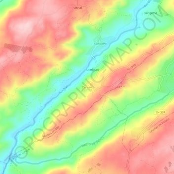
Name: Penedo topographic map, elevation, terrain.
Location: Penedo, Lajeosa do Dão, Tondela, Viseu, 3460-160, Portugal (40.48430 -8.00839 40.52430 -7.96839)
Average elevation: 860 ft
Minimum elevation: 505 ft
Maximum elevation: 1,184 ft
Thank you for supporting this site ❤️
Make a donation
Make a donation
Gear up for your next adventure:
As an Amazon Associate, this site earns from qualifying purchases at no extra cost to you.