Geolocate

Gattu topographic map

Click on the map to display elevation.

About this map

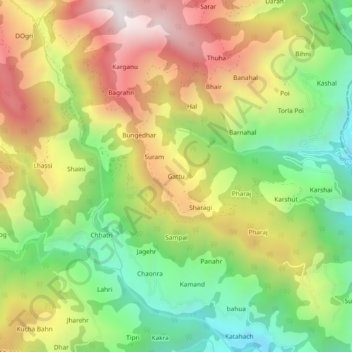
Name: Gattu topographic map, elevation, terrain.

Location: Gattu, Thunag, Mandi District, Himachal Pradesh, India (31.45313 77.27933 31.49313 77.31933)

Average elevation: 6,785 ft

Minimum elevation: 4,984 ft

Maximum elevation: 8,894 ft

Gear up for your next adventure:

📚USA Hiking Guide Books - Top trail guides and map books
🕶️GPS Smartphone Mount - Secure mount for phone navigation
🌎3D Topographic Globes - Raised relief globes for a tactile understanding of geography
🧣Hiking Neck Gaiter - Multi‑use neck protection for outdoor weather
🍳Camping Cook Set - Complete cookware for outdoor meals

As an Amazon Associate, this site earns from qualifying purchases at no extra cost to you.