
Thank you for supporting this site ❤️
Make a donation
Make a donation
Gear up for your next adventure:
As an Amazon Associate, this site earns from qualifying purchases at no extra cost to you.
Tinderet topographic map
Click on the map to display elevation.
Thank you for supporting this site ❤️
Make a donation
Make a donation
Gear up for your next adventure:
As an Amazon Associate, this site earns from qualifying purchases at no extra cost to you.
About this map
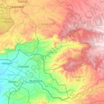
Name: Tinderet topographic map, elevation, terrain.
Location: Tinderet, Nandi County, Rift Valley, Kenya (-0.10975 34.93817 0.07326 35.43891)
Average elevation: 6,178 ft
Minimum elevation: 3,852 ft
Maximum elevation: 9,393 ft
Thank you for supporting this site ❤️
Make a donation
Make a donation
Gear up for your next adventure:
As an Amazon Associate, this site earns from qualifying purchases at no extra cost to you.