Geolocate

Bell topographic map

Click on the map to display elevation.

About this map

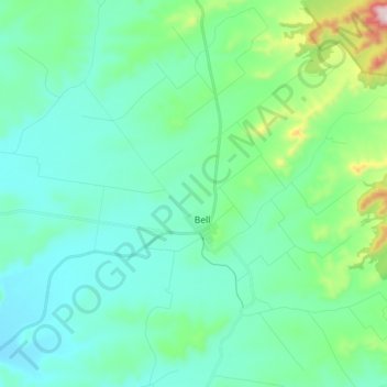
Name: Bell topographic map, elevation, terrain.

Location: Bell, Western Downs Regional, Queensland, 4408, Australia (-26.99862 151.36941 -26.83426 151.50643)

Average elevation: 1,634 ft

Minimum elevation: 1,286 ft

Maximum elevation: 3,219 ft

Gear up for your next adventure:

🔥Fast-Boil Camping Stoves - Efficient cooking systems for quick trail meals
🥾Women's Hiking Boots - Top-rated trail boots with ankle support and superior grip
☀️Outdoor Sunscreen - High protection sunscreen for outdoor activities
🪶LED Camping Lantern - Bright lantern for camp lighting
🪶Fire Starter Kit - Reliable fire starter for survival and camping

As an Amazon Associate, this site earns from qualifying purchases at no extra cost to you.