
Thank you for supporting this site ❤️
Make a donation
Make a donation
Gear up for your next adventure:
As an Amazon Associate, this site earns from qualifying purchases at no extra cost to you.
Odai topographic map
Click on the map to display elevation.
Thank you for supporting this site ❤️
Make a donation
Make a donation
Gear up for your next adventure:
As an Amazon Associate, this site earns from qualifying purchases at no extra cost to you.
About this map
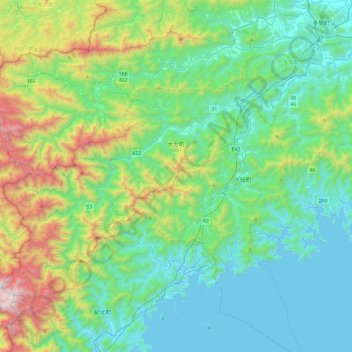
Name: Odai topographic map, elevation, terrain.
Location: Odai, Taki County, Mie Prefecture, 519-2404, Japan (34.16463 136.09265 34.45966 136.55302)
Average elevation: 1,250 ft
Minimum elevation: -7 ft
Maximum elevation: 5,502 ft
Thank you for supporting this site ❤️
Make a donation
Make a donation
Gear up for your next adventure:
As an Amazon Associate, this site earns from qualifying purchases at no extra cost to you.