Geolocate

Maplewood topographic map

Click on the map to display elevation.

About this map

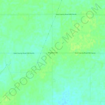
Name: Maplewood topographic map, elevation, terrain.

Location: Maplewood, Hendricks County, Indiana, United States (39.81449 -86.52528 39.85449 -86.48528)

Average elevation: 942 ft

Minimum elevation: 922 ft

Maximum elevation: 958 ft

Hendricks County trails, hiking, mountain biking, running and outdoor activities

Other topographic maps

Click on a map to view its topography, its elevation and its terrain.

North Salem

United States > Indiana > Hendricks County

Average elevation: 912 ft

Stilesville

United States > Indiana > Hendricks County

Average elevation: 787 ft

Coatesville

United States > Indiana > Hendricks County

Average elevation: 889 ft

Pittsboro

United States > Indiana > Hendricks County

Average elevation: 935 ft

Amo

United States > Indiana > Hendricks County

Average elevation: 837 ft

Avon

United States > Indiana > Hendricks County

Average elevation: 833 ft

Danville

United States > Indiana > Hendricks County

Average elevation: 922 ft

Clayton

United States > Indiana > Hendricks County

Average elevation: 863 ft

Lizton

United States > Indiana > Hendricks County

Average elevation: 958 ft

Gear up for your next adventure:

🦶Hiking Gaiters - Keep debris and water out of your boots
💧Water Filtration Bottles - Safely drink from streams and lakes while exploring
🪶Paracord Bracelet - Survival bracelet with built‑in tools
🛠️Outdoor Gear Repair Kit - Essential tools to fix gear on the trail
📌Outdoor GPS Map App - Apps and devices for digital topographic navigation

As an Amazon Associate, this site earns from qualifying purchases at no extra cost to you.