
Thank you for supporting this site ❤️
Make a donation
Make a donation
Gear up for your next adventure:
As an Amazon Associate, this site earns from qualifying purchases at no extra cost to you.
Polling im Innkreis topographic map
Click on the map to display elevation.
Thank you for supporting this site ❤️
Make a donation
Make a donation
Gear up for your next adventure:
As an Amazon Associate, this site earns from qualifying purchases at no extra cost to you.
About this map
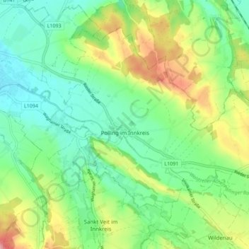
Name: Polling im Innkreis topographic map, elevation, terrain.
Location: Polling im Innkreis, Bezirk Braunau am Inn, 4951, Austria (48.20952 13.26171 48.25372 13.34665)
Average elevation: 1,342 ft
Minimum elevation: 1,191 ft
Maximum elevation: 1,627 ft
Thank you for supporting this site ❤️
Make a donation
Make a donation
Gear up for your next adventure:
As an Amazon Associate, this site earns from qualifying purchases at no extra cost to you.