Geolocate

Narangpur topographic map

Click on the map to display elevation.

About this map

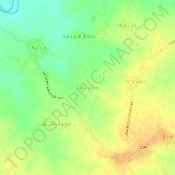
Name: Narangpur topographic map, elevation, terrain.

Location: Narangpur, Ambabhona, Bargarh District, Odisha, 768045, India (21.58015 83.38753 21.62015 83.42753)

Average elevation: 682 ft

Minimum elevation: 623 ft

Maximum elevation: 728 ft

Gear up for your next adventure:

🔋Rechargeable Batteries - Power up your outdoor devices
🥤Water Filter Bottle - All‑in‑one filter bottle for safe hydration
🪶Paracord Bracelet - Survival bracelet with built‑in tools
🎒Hydration Pack - Hands‑free water reservoir for long hikes
🔭Telescopic Hiking Pole - Adjustable pole for hiking stability

As an Amazon Associate, this site earns from qualifying purchases at no extra cost to you.