
Thank you for supporting this site ❤️
Make a donation
Make a donation
Gear up for your next adventure:
As an Amazon Associate, this site earns from qualifying purchases at no extra cost to you.
Petit-Axhe topographic map
Click on the map to display elevation.
Thank you for supporting this site ❤️
Make a donation
Make a donation
Gear up for your next adventure:
As an Amazon Associate, this site earns from qualifying purchases at no extra cost to you.
About this map
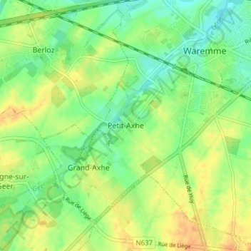
Name: Petit-Axhe topographic map, elevation, terrain.
Location: Petit-Axhe, Waremme, Liège, Wallonia, 4300, Belgium (50.66579 5.21469 50.70579 5.25469)
Average elevation: 410 ft
Minimum elevation: 361 ft
Maximum elevation: 459 ft
Thank you for supporting this site ❤️
Make a donation
Make a donation
Gear up for your next adventure:
As an Amazon Associate, this site earns from qualifying purchases at no extra cost to you.