
Kin topographic map
Click on the map to display elevation.
About this map
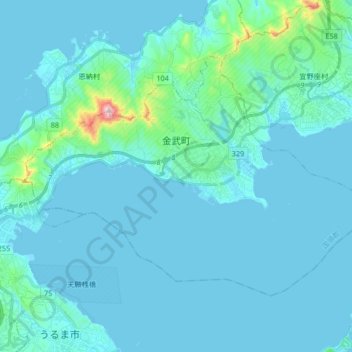
Name: Kin topographic map, elevation, terrain.
Location: Kin, Kunigami, Okinawa Prefecture, Japan (26.40064 127.83531 26.50207 128.00169)
Average elevation: 92 ft
Minimum elevation: 0 ft
Maximum elevation: 1,158 ft
Other topographic maps
Click on a map to view its topography, its elevation and its terrain.