
Make a donation
Gear up for your next adventure:
As an Amazon Associate, this site earns from qualifying purchases at no extra cost to you.
Moerzeke topographic map
Click on the map to display elevation.
Make a donation
Gear up for your next adventure:
As an Amazon Associate, this site earns from qualifying purchases at no extra cost to you.
About this map
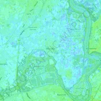
Name: Moerzeke topographic map, elevation, terrain.
Location: Moerzeke, Hamme, Dendermonde, Oost-Vlaanderen, 9220, België (51.03224 4.12114 51.09159 4.19918)
Average elevation: 10 ft
Minimum elevation: -10 ft
Maximum elevation: 30 ft
Make a donation
Gear up for your next adventure:
As an Amazon Associate, this site earns from qualifying purchases at no extra cost to you.
Other topographic maps
Click on a map to view its topography, its elevation and its terrain.
Kastel
België > Oost-Vlaanderen > Dendermonde > Hamme > Moerzeke
Het gebied langs de Schelde was vroeger een laaggelegen moerasland, dat tweemaal per dag overspoelde door de getijdenbeweging. Enkele hoogten, die later de naam Ganzenberg, Ripipiaberg en Stuyfbergen kregen, staken erbovenuit.
Average elevation: 10 ft
Schorren van de Durme, de Bunt en monding van de Durme in de Schelde
België > Oost-Vlaanderen > Dendermonde > Hamme
Average elevation: 23 ft