
Reigoldswil topographic map
Interactive map
Click on the map to display elevation.
About this map
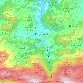
Name: Reigoldswil topographic map, elevation, terrain.
Location: Reigoldswil, Bezirk Waldenburg, Bâle-Campagne, 4418, Suisse (47.37118 7.66303 47.41556 7.71224)
Average elevation: 2,415 ft
Minimum elevation: 1,532 ft
Maximum elevation: 3,799 ft
Other topographic maps
Click on a map to view its topography, its elevation and its terrain.
Langenbruck
Suisse > Bâle-Campagne > Bezirk Waldenburg > Langenbruck
Langenbruck, Bezirk Waldenburg, Bâle-Campagne, 4438, Suisse
Average elevation: 2,713 ft