
Make a donation
Gear up for your next adventure:
As an Amazon Associate, this site earns from qualifying purchases at no extra cost to you.
Alexanderschanze topographic map
Click on the map to display elevation.
Make a donation
Gear up for your next adventure:
As an Amazon Associate, this site earns from qualifying purchases at no extra cost to you.
Alexanderschanze
Alexanderschanze ist eine Passhöhe (Höhe 970,8 m ü. NHN) an der Bundesstraße 28 bei Freudenstadt im Nordschwarzwald. Gleichzeitig gibt es die Festungsanlage Alexanderschanze und schließlich das Hotel Alexanderschanze.
Make a donation
Gear up for your next adventure:
As an Amazon Associate, this site earns from qualifying purchases at no extra cost to you.
About this map
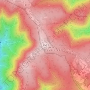
Name: Alexanderschanze topographic map, elevation, terrain.
Average elevation: 2,884 ft
Minimum elevation: 2,096 ft
Maximum elevation: 3,182 ft
Make a donation
Gear up for your next adventure:
As an Amazon Associate, this site earns from qualifying purchases at no extra cost to you.