Geolocate

Lac Duburon topographic map

Click on the map to display elevation.

About this map

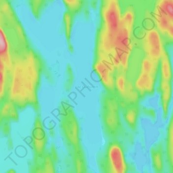
Name: Lac Duburon topographic map, elevation, terrain.

Location: Lac Duburon, Rivière-aux-Outardes, Manicouagan, Côte-Nord, Québec, Canada (49.86135 -67.99686 49.91854 -67.95227)

Average elevation: 1,329 ft

Minimum elevation: 1,175 ft

Maximum elevation: 1,772 ft

Other topographic maps

Click on a map to view its topography, its elevation and its terrain.

Manic 5.

Canada > Québec > Manicouagan > Rivière-aux-Outardes

Average elevation: 1,145 ft

Monts-Groulx

Canada > Québec > Manicouagan > Rivière-aux-Outardes

Average elevation: 3,235 ft

Lac Boston

Canada > Québec > Manicouagan > Rivière-aux-Outardes

Average elevation: 1,227 ft

Lac Porc

Canada > Québec > Manicouagan > Rivière-aux-Outardes

Average elevation: 1,142 ft

Lac Beaudry

Canada > Québec > Manicouagan > Rivière-aux-Outardes

Average elevation: 1,427 ft

Lac Després

Canada > Québec > Manicouagan > Rivière-aux-Outardes

Average elevation: 1,230 ft

Lac du Centre

Canada > Québec > Manicouagan > Rivière-aux-Outardes

Average elevation: 1,280 ft

Lac Varin

Canada > Québec > Manicouagan > Rivière-aux-Outardes

Average elevation: 1,266 ft

Lac Louise

Canada > Québec > Manicouagan > Rivière-aux-Outardes

Average elevation: 1,385 ft

Gear up for your next adventure:

📚USA Hiking Guide Books - Top trail guides and map books
🦶Carbon Trekking Poles - Reduce knee impact on steep descents with ultra-light poles
🌡️Handheld Weather Meters - Measure wind, temp, and pressure for safe mountain travel
🍳Camping Cook Set - Complete cookware for outdoor meals
⛑️Personal Locator Beacon - Safety beacon for emergencies

As an Amazon Associate, this site earns from qualifying purchases at no extra cost to you.