Geolocate

Nitturu topographic map

Click on the map to display elevation.

About this map

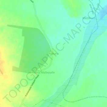
Name: Nitturu topographic map, elevation, terrain.

Location: Nitturu, Yellanur, Anantapur District, Andhra Pradesh, India (14.71428 78.04068 14.75428 78.08068)

Average elevation: 771 ft

Minimum elevation: 735 ft

Maximum elevation: 817 ft

Gear up for your next adventure:

📷Action Camera - Capture your outdoor adventures in HD
🧤Hiking Gloves - Protective gloves for rugged trails
🚪Portable Camp Chair - Foldable chair for comfort at camp
🕶️GPS Smartphone Mount - Secure mount for phone navigation
💧Water Purification System - Clean water on the trail with reliable purifiers

As an Amazon Associate, this site earns from qualifying purchases at no extra cost to you.