Geolocate

Hajin topographic map

Click on the map to display elevation.

About this map

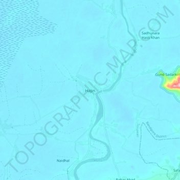
Name: Hajin topographic map, elevation, terrain.

Location: Hajin, Sonawari, Bandipore, Jammu and Kashmir, 193501, India (34.25584 74.57787 34.33584 74.65787)

Average elevation: 5,190 ft

Minimum elevation: 5,167 ft

Maximum elevation: 5,863 ft

Gear up for your next adventure:

🪄Magnetic Compass - Accurate compass for navigation
🔋Solar Power Banks - Keep your GPS and phone charged in remote wilderness areas
🔌Solar Panel Charger - Charge gear sustainably outdoors
📖Nature Tracking Books - Learn to track wildlife and terrain
🛰️Satellite Messengers - Emergency SOS and two-way messaging for off-grid adventures

As an Amazon Associate, this site earns from qualifying purchases at no extra cost to you.