Geolocate

Matara topographic map

Click on the map to display elevation.

About this map

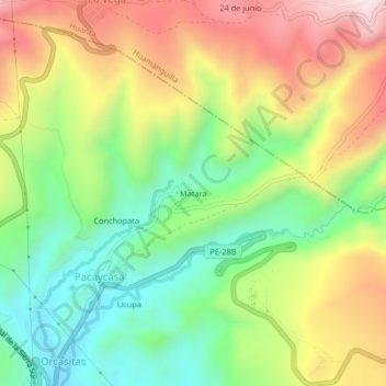
Name: Matara topographic map, elevation, terrain.

Location: Matara, Pacaycasa, Ayacucho, Perú (-13.06922 -74.22589 -13.02922 -74.18589)

Average elevation: 8,934 ft

Minimum elevation: 8,130 ft

Maximum elevation: 9,974 ft

Gear up for your next adventure:

🚗GPS Dash Cams - Record your scenic drives through mountain passes and canyons
📦Gear Storage Bags - Organize and protect outdoor equipment
🔦LED Headlamp - Bright and durable LED headlamp for night navigation
🧦Merino Wool Socks - Moisture-wicking, blister-preventing socks for long treks
📷Action Cameras - Rugged cameras to document your journeys across rugged terrain

As an Amazon Associate, this site earns from qualifying purchases at no extra cost to you.