
Thank you for supporting this site ❤️
Make a donation
Make a donation
Gear up for your next adventure:
As an Amazon Associate, this site earns from qualifying purchases at no extra cost to you.
Marguns topographic map
Click on the map to display elevation.
Thank you for supporting this site ❤️
Make a donation
Make a donation
Gear up for your next adventure:
As an Amazon Associate, this site earns from qualifying purchases at no extra cost to you.
About this map
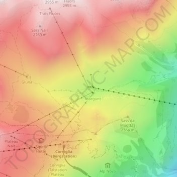
Name: Marguns topographic map, elevation, terrain.
Location: Marguns, Celerina/Schlarigna, Maloja, Grisons, 7500, Switzerland (46.50646 9.81473 46.52646 9.83473)
Average elevation: 7,917 ft
Minimum elevation: 6,053 ft
Maximum elevation: 9,232 ft
Thank you for supporting this site ❤️
Make a donation
Make a donation
Gear up for your next adventure:
As an Amazon Associate, this site earns from qualifying purchases at no extra cost to you.