Geolocate

Lily topographic map

Click on the map to display elevation.

About this map

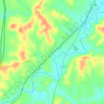
Name: Lily topographic map, elevation, terrain.

Location: Lily, Laurel County, Kentucky, 40740, United States (37.00459 -84.09489 37.04459 -84.05489)

Average elevation: 1,148 ft

Minimum elevation: 1,066 ft

Maximum elevation: 1,276 ft

Laurel County trails, hiking, mountain biking, running and outdoor activities

Other topographic maps

Click on a map to view its topography, its elevation and its terrain.

North Corbin

United States > Kentucky > Laurel County > North Corbin

Average elevation: 1,152 ft

Gear up for your next adventure:

🌄Hiking Binoculars - Compact binoculars for scenic views and trail spotting
🧼Biodegradable Camping Soap - Eco‑friendly soap for outdoor hygiene
🦶Hiking Gaiters - Keep debris and water out of your boots
👓Polarized Sunglasses - Outdoor sunglasses for glare reduction
🧣Merino Neck Gaiters - Multi-functional headwear for wind and sun protection

As an Amazon Associate, this site earns from qualifying purchases at no extra cost to you.