
Thank you for supporting this site ❤️
Make a donation
Make a donation
Gear up for your next adventure:
As an Amazon Associate, this site earns from qualifying purchases at no extra cost to you.
Alphubel topographic map
Click on the map to display elevation.
Thank you for supporting this site ❤️
Make a donation
Make a donation
Gear up for your next adventure:
As an Amazon Associate, this site earns from qualifying purchases at no extra cost to you.
About this map
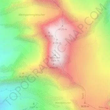
Name: Alphubel topographic map, elevation, terrain.
Location: Alphubel, Täsch, Viège, Valais, 3929, Suisse (46.06283 7.86380 46.06293 7.86390)
Average elevation: 11,857 ft
Minimum elevation: 9,760 ft
Maximum elevation: 13,760 ft
Thank you for supporting this site ❤️
Make a donation
Make a donation
Gear up for your next adventure:
As an Amazon Associate, this site earns from qualifying purchases at no extra cost to you.