
Garrison topographic map
Click on the map to display elevation.
About this map
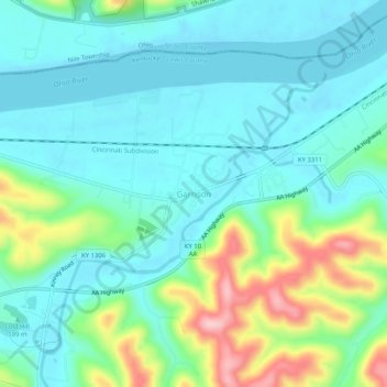
Name: Garrison topographic map, elevation, terrain.
Location: Garrison, Lewis County, Kentucky, 41141, United States (38.58447 -83.19209 38.62447 -83.15209)
Average elevation: 643 ft
Minimum elevation: 492 ft
Maximum elevation: 1,102 ft
Lewis County trails, hiking, mountain biking, running and outdoor activities
Other topographic maps
Click on a map to view its topography, its elevation and its terrain.