Geolocate

Ewalto topographic map

Click on the map to display elevation.

About this map

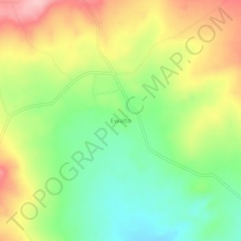
Name: Ewalto topographic map, elevation, terrain.

Location: Ewalto, Esan South-East, Edo State, Nigeria (6.47465 6.34748 6.51465 6.38748)

Average elevation: 558 ft

Minimum elevation: 299 ft

Maximum elevation: 879 ft

Gear up for your next adventure:

🌲Outdoor Survival Books - Best books on survival skills
Solar GPS Watches - Advanced multisport watches with built-in topographic maps
🧯Emergency Survival Kit - All‑in‑one survival essentials for the backcountry
🧤Hiking Gloves - Protective gloves for rugged trails
🔋Rechargeable Batteries - Power up your outdoor devices

As an Amazon Associate, this site earns from qualifying purchases at no extra cost to you.