Geolocate

Ray Mountain topographic map

Click on the map to display elevation.

About this map

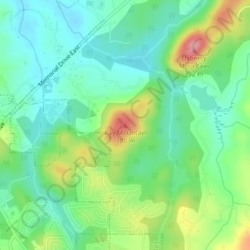
Name: Ray Mountain topographic map, elevation, terrain.

Location: Ray Mountain, Paulding County, Georgia, 30132, United States (33.92978 -84.81388 33.92988 -84.81378)

Average elevation: 1,004 ft

Minimum elevation: 876 ft

Maximum elevation: 1,266 ft

Paulding County trails, hiking, mountain biking, running and outdoor activities

Other topographic maps

Click on a map to view its topography, its elevation and its terrain.

Braswell

United States > Georgia > Paulding County

Average elevation: 1,079 ft

Gear up for your next adventure:

🗺️NatGeo Topo Maps - High-quality waterproof printed topographic maps of US Parks
🔭Telescopic Hiking Pole - Adjustable pole for hiking stability
🧣Hiking Neck Gaiter - Multi‑use neck protection for outdoor weather
👟Trail Running Shoes - Lightweight shoes for trail runners
🏔️Mountain Trail Maps - High‑detail maps for popular peaks

As an Amazon Associate, this site earns from qualifying purchases at no extra cost to you.