Geolocate

Source Is Shapefile From Town topographic map

Click on the map to display elevation.

About this map

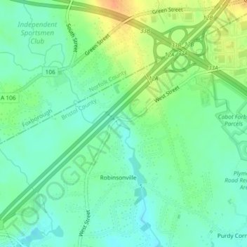
Name: Source Is Shapefile From Town topographic map, elevation, terrain.

Location: Source Is Shapefile From Town, West Street, Robinsonville, Mansfield, Bristol County, Massachusetts, 02048, United States (42.01809 -71.26571 42.01896 -71.26512)

Average elevation: 164 ft

Minimum elevation: 118 ft

Maximum elevation: 243 ft

Gear up for your next adventure:

👓Polarized Sunglasses - Outdoor sunglasses for glare reduction
📶Satellite Messenger - Communication device off‑grid
🚗GPS Dash Cams - Record your scenic drives through mountain passes and canyons
🩹Survival Bandages - High‑quality bandages for emergencies
🧯Portable Fire Pit - Compact fire pit for camping spots

As an Amazon Associate, this site earns from qualifying purchases at no extra cost to you.