
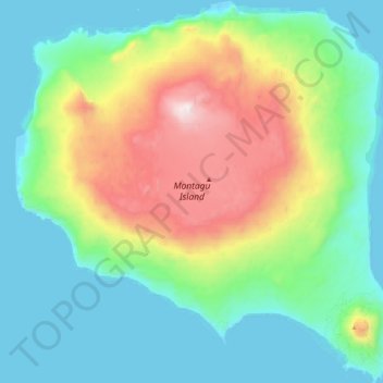
Montagu Island topographic map
Interactive map
Click on the map to display elevation.
About this map
Name: Montagu Island topographic map, elevation, terrain.
Average elevation: 1,020 ft
Minimum elevation: -3 ft
Maximum elevation: 3,632 ft
Other topographic maps
Click on a map to view its topography, its elevation and its terrain.
Cook Island
South Georgia and the South Sandwich Islands > South Sandwich Islands
Cook Island, South Sandwich Islands, South Georgia and the South Sandwich Islands
Average elevation: 659 ft