
蛇口街道 topographic map
Interactive map
Click on the map to display elevation.
About this map
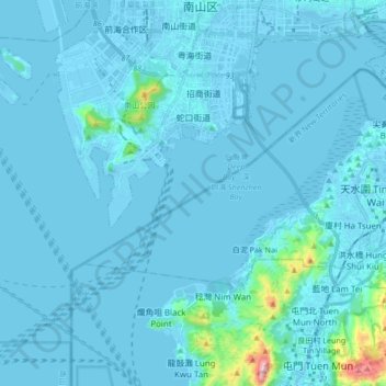
Name: 蛇口街道 topographic map, elevation, terrain.
Location: 蛇口街道, 南山区, 深圳市, 广东省, 518000, 中国 (22.40003 113.78177 22.51989 113.95063)
Average elevation: 89 ft
Minimum elevation: -39 ft
Maximum elevation: 1,808 ft
Other topographic maps
Click on a map to view its topography, its elevation and its terrain.