Geolocate

Sturgis topographic map

Click on the map to display elevation.

About this map

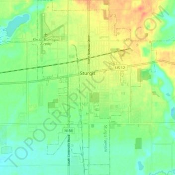
Name: Sturgis topographic map, elevation, terrain.

Location: Sturgis, Saint Joseph County, Michigan, 49091, United States (41.76317 -85.44543 41.82482 -85.38669)

Average elevation: 906 ft

Minimum elevation: 843 ft

Maximum elevation: 991 ft

Other topographic maps

Click on a map to view its topography, its elevation and its terrain.

Sandy Beach

United States > Michigan > Saint Joseph County

Average elevation: 843 ft

Gear up for your next adventure:

🕶️GPS Smartphone Mount - Secure mount for phone navigation
🏔️Mountain Trail Maps - High‑detail maps for popular peaks
🎒Trekking Poles - Sturdy poles for balance and stability on rough terrain
🔥Plasma Lighters - Windproof lighters that work in any weather condition
🪶Compact Camp Shovel - Folding shovel for campsite tasks

As an Amazon Associate, this site earns from qualifying purchases at no extra cost to you.