
Thank you for supporting this site ❤️
Make a donation
Make a donation
Gear up for your next adventure:
As an Amazon Associate, this site earns from qualifying purchases at no extra cost to you.
Oshima topographic map
Click on the map to display elevation.
Thank you for supporting this site ❤️
Make a donation
Make a donation
Gear up for your next adventure:
As an Amazon Associate, this site earns from qualifying purchases at no extra cost to you.
About this map
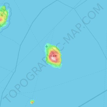
Name: Oshima topographic map, elevation, terrain.
Location: Oshima, Oshima Subprefecture, Tokyo, 100-0103, Japan (34.49824 139.18023 34.99846 139.78484)
Average elevation: 33 ft
Minimum elevation: 0 ft
Maximum elevation: 2,428 ft
Thank you for supporting this site ❤️
Make a donation
Make a donation
Gear up for your next adventure:
As an Amazon Associate, this site earns from qualifying purchases at no extra cost to you.