
Winterbourne topographic map
Interactive map
Click on the map to display elevation.
About this map
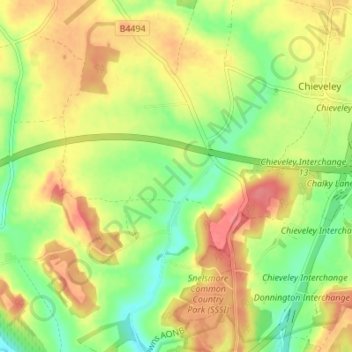
Name: Winterbourne topographic map, elevation, terrain.
Location: Winterbourne, West Berkshire, England, United Kingdom (51.43043 -1.36594 51.47305 -1.33106)
Average elevation: 394 ft
Minimum elevation: 282 ft
Maximum elevation: 502 ft
Other topographic maps
Click on a map to view its topography, its elevation and its terrain.
Greenham
United Kingdom > England > West Berkshire
Greenham, West Berkshire, England, United Kingdom
Average elevation: 308 ft