
Make a donation
Gear up for your next adventure:
As an Amazon Associate, this site earns from qualifying purchases at no extra cost to you.
Fato topographic map
Click on the map to display elevation.
Make a donation
Gear up for your next adventure:
As an Amazon Associate, this site earns from qualifying purchases at no extra cost to you.
About this map
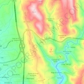
Name: Fato topographic map, elevation, terrain.
Location: Fato, Aguda, Figueiró dos Vinhos, Leiria, 3260-021, Portugal (39.90550 -8.35086 39.94550 -8.31086)
Average elevation: 1,191 ft
Minimum elevation: 666 ft
Maximum elevation: 1,798 ft
Make a donation
Gear up for your next adventure:
As an Amazon Associate, this site earns from qualifying purchases at no extra cost to you.
Other topographic maps
Click on a map to view its topography, its elevation and its terrain.
Fragas de São Simão
Portugal > Leiria > Figueiró dos Vinhos > Aguda > Ponte de São Simão
Average elevation: 1,171 ft
Make a donation
Gear up for your next adventure:
As an Amazon Associate, this site earns from qualifying purchases at no extra cost to you.