
Fenmore Park topographic map
Interactive map
Click on the map to display elevation.
About this map
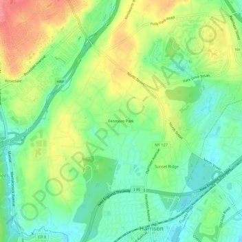
Name: Fenmore Park topographic map, elevation, terrain.
Average elevation: 125 ft
Minimum elevation: 20 ft
Maximum elevation: 276 ft
Other topographic maps
Click on a map to view its topography, its elevation and its terrain.
West Harrison Village Green
United States > New York > Westchester County > Town/Village of Harrison > East White Plains
West Harrison Village Green, East White Plains, Town/Village of Harrison, Westchester County, New York, United States
Average elevation: 259 ft