
Mauloff topographic map
Click on the map to display elevation.
About this map
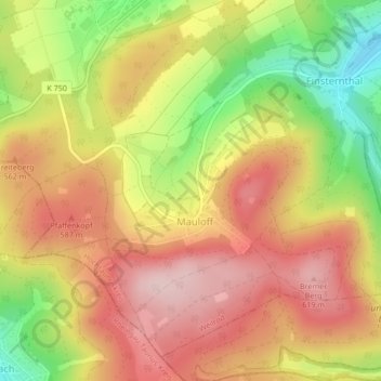
Name: Mauloff topographic map, elevation, terrain.
Location: Mauloff, Weilrod, Hochtaunuskreis, Hesse, Germany (50.27433 8.37872 50.29779 8.41275)
Average elevation: 1,719 ft
Minimum elevation: 1,237 ft
Maximum elevation: 2,067 ft
Other topographic maps
Click on a map to view its topography, its elevation and its terrain.
Großer Feldberg
Germany > Hesse > Hochtaunuskreis > Schmitten im Taunus
The Großer Feldberg ('Great Field Mountain') is, at a height of 879.5 metres, the highest elevation of the Taunus mountains, and of the entire Rhenish Massif. It is situated in the Hochtaunuskreis district in Hesse, Germany.
Average elevation: 2,349 ft
Saubach und Niedgesbach bei Schmitten
Germany > Hesse > Hochtaunuskreis > Finsternthal
Average elevation: 1,801 ft