
Büdingen topographic map
Interactive map
Click on the map to display elevation.
About this map
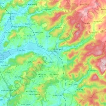
Name: Büdingen topographic map, elevation, terrain.
Location: Büdingen, Wetteraukreis, Hesse, 63654, Allemagne (50.22992 8.99986 50.34381 9.22762)
Average elevation: 712 ft
Minimum elevation: 394 ft
Maximum elevation: 1,316 ft
Other topographic maps
Click on a map to view its topography, its elevation and its terrain.