
Thank you for supporting this site ❤️
Make a donation
Make a donation
Gear up for your next adventure:
As an Amazon Associate, this site earns from qualifying purchases at no extra cost to you.
Surrein topographic map
Click on the map to display elevation.
Thank you for supporting this site ❤️
Make a donation
Make a donation
Gear up for your next adventure:
As an Amazon Associate, this site earns from qualifying purchases at no extra cost to you.
About this map
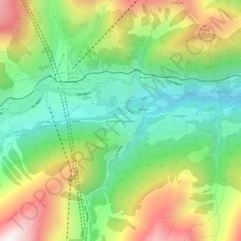
Name: Surrein topographic map, elevation, terrain.
Location: Surrein, Sedrun, Tujetsch, Surselva, Grisons, 7188, Suisse (46.65462 8.76068 46.69462 8.80068)
Average elevation: 5,387 ft
Minimum elevation: 4,042 ft
Maximum elevation: 7,474 ft
Thank you for supporting this site ❤️
Make a donation
Make a donation
Gear up for your next adventure:
As an Amazon Associate, this site earns from qualifying purchases at no extra cost to you.