
Dumagbe topographic map
Interactive map
Click on the map to display elevation.
About this map
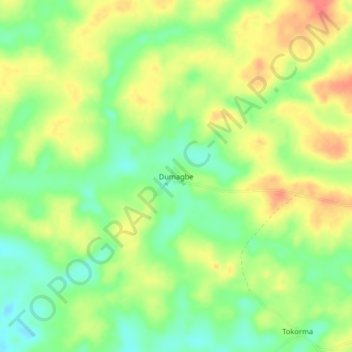
Name: Dumagbe topographic map, elevation, terrain.
Average elevation: 171 ft
Minimum elevation: 85 ft
Maximum elevation: 256 ft
Other topographic maps
Click on a map to view its topography, its elevation and its terrain.
Mopani
Sierra Leone > Pujehun District > Mopani
Mopani, Pujehun District, Southern Province, Sierra Leone
Average elevation: 121 ft