
Thank you for supporting this site ❤️
Make a donation
Make a donation
Gear up for your next adventure:
As an Amazon Associate, this site earns from qualifying purchases at no extra cost to you.
Yosa topographic map
Click on the map to display elevation.
Thank you for supporting this site ❤️
Make a donation
Make a donation
Gear up for your next adventure:
As an Amazon Associate, this site earns from qualifying purchases at no extra cost to you.
About this map
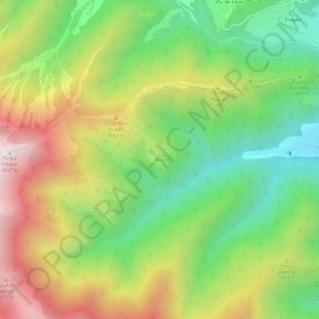
Name: Yosa topographic map, elevation, terrain.
Location: Yosa, Broto, Sobrarbe, Huesca, Aragón, 22378, España (42.57441 -0.18442 42.61441 -0.14442)
Average elevation: 4,547 ft
Minimum elevation: 3,048 ft
Maximum elevation: 6,549 ft
Thank you for supporting this site ❤️
Make a donation
Make a donation
Gear up for your next adventure:
As an Amazon Associate, this site earns from qualifying purchases at no extra cost to you.