
Thank you for supporting this site ❤️
Make a donation
Make a donation
Gear up for your next adventure:
As an Amazon Associate, this site earns from qualifying purchases at no extra cost to you.
Gundu topographic map
Click on the map to display elevation.
Thank you for supporting this site ❤️
Make a donation
Make a donation
Gear up for your next adventure:
As an Amazon Associate, this site earns from qualifying purchases at no extra cost to you.
About this map
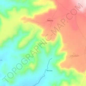
Name: Gundu topographic map, elevation, terrain.
Location: Gundu, Gwangang Chata, Hawul, Borno State, Nigeria (10.37146 12.05208 10.41146 12.09208)
Average elevation: 1,916 ft
Minimum elevation: 1,421 ft
Maximum elevation: 2,526 ft
Thank you for supporting this site ❤️
Make a donation
Make a donation
Gear up for your next adventure:
As an Amazon Associate, this site earns from qualifying purchases at no extra cost to you.