
Bukovel topographic map
Click on the map to display elevation.
Bukovel
Bukovel (Ukrainian: Буковель) is the largest ski resort in Eastern Europe situated in Ukraine, in Nadvirna Raion, Ivano-Frankivsk Oblast (province) of western Ukraine. A part of it is in state property. The resort is located almost on the ridge-lines of the Carpathian Mountains at elevation of 900 m (3,000 ft) above the sea level near the village of Polianytsia (about 1.3 km (0.81 mi) away). It is one of the most popular ski resorts in the Ukrainian Carpathian Mountains and is situated 30 km (19 mi) southwest of the city of Yaremche. In 2012, Bukovel was named the fastest-growing ski resort in the world.
About this map
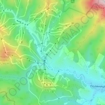
Name: Bukovel topographic map, elevation, terrain.
Average elevation: 3,310 ft
Minimum elevation: 2,762 ft
Maximum elevation: 4,721 ft