Geolocate

Bodffordd topographic map

Click on the map to display elevation.

About this map

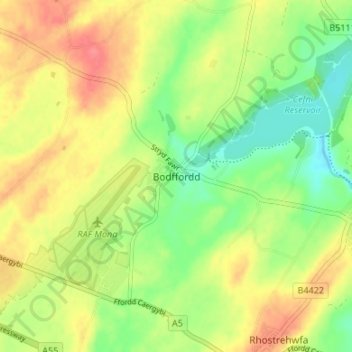
Name: Bodffordd topographic map, elevation, terrain.

Location: Bodffordd, Isle of Anglesey, Wales, LL77 7LQ, United Kingdom (53.24402 -4.37939 53.28402 -4.33939)

Average elevation: 184 ft

Minimum elevation: 79 ft

Maximum elevation: 295 ft

Other topographic maps

Click on a map to view its topography, its elevation and its terrain.

Holy Island

United Kingdom > Wales > Isle of Anglesey > Trearddur

Average elevation: 30 ft

Anglesey

United Kingdom > Wales > Isle of Anglesey

Average elevation: 141 ft

Rhoscolyn

United Kingdom > Wales > Isle of Anglesey > Rhoscolyn

Average elevation: 30 ft

Llanfaelog

United Kingdom > Wales > Isle of Anglesey

Average elevation: 52 ft

Puffin Island

United Kingdom > Wales > Isle of Anglesey

Average elevation: 3 ft

Moelfre

United Kingdom > Wales > Isle of Anglesey > Brynrefail

Average elevation: 141 ft

Llanfachraeth

United Kingdom > Wales > Isle of Anglesey

Average elevation: 43 ft

Llannerch-y-Medd

United Kingdom > Wales > Isle of Anglesey

Average elevation: 217 ft

Trearddur

United Kingdom > Wales > Isle of Anglesey

Average elevation: 30 ft

Valley

United Kingdom > Wales > Isle of Anglesey

Average elevation: 20 ft

Anglesey

United Kingdom > Wales > Isle of Anglesey

Average elevation: 141 ft

Valley

United Kingdom > Wales > Isle of Anglesey

Average elevation: 20 ft

Menai Bridge

United Kingdom > Wales > Isle of Anglesey

Average elevation: 157 ft

Anglesey

United Kingdom > Wales > Isle of Anglesey

Average elevation: 141 ft

Anglesey

United Kingdom > Wales > Isle of Anglesey

Average elevation: 141 ft

Anglesey

United Kingdom > Wales > Isle of Anglesey

Average elevation: 141 ft

Llanfaelog

United Kingdom > Wales > Isle of Anglesey

Average elevation: 52 ft

Gear up for your next adventure:

🪓Survival Multi‑Tool - Versatile tool for camp and trail tasks
🗺️NatGeo Topo Maps - High-quality waterproof printed topographic maps of US Parks
🦟Ultrasonic Repellers - Create a bug-free zone at your camp or rest stop
🧭Map Reading Tools - Tools and kits for map navigation
GPS Sports Watch - GPS watch for running, hiking and training

As an Amazon Associate, this site earns from qualifying purchases at no extra cost to you.