
Thank you for supporting this site ❤️
Make a donation
Make a donation
Gear up for your next adventure:
As an Amazon Associate, this site earns from qualifying purchases at no extra cost to you.
Huilacapixtla topographic map
Click on the map to display elevation.
Thank you for supporting this site ❤️
Make a donation
Make a donation
Gear up for your next adventure:
As an Amazon Associate, this site earns from qualifying purchases at no extra cost to you.
About this map
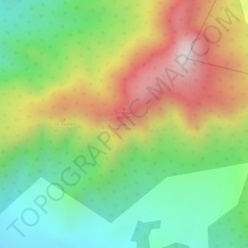
Name: Huilacapixtla topographic map, elevation, terrain.
Location: Huilacapixtla, Tlaxco, Tlaxcala, Mexico (19.63301 -98.04949 19.63311 -98.04939)
Average elevation: 10,213 ft
Minimum elevation: 9,219 ft
Maximum elevation: 11,444 ft
Thank you for supporting this site ❤️
Make a donation
Make a donation
Gear up for your next adventure:
As an Amazon Associate, this site earns from qualifying purchases at no extra cost to you.