
Hammam Beni Salah topographic map
Interactive map
Click on the map to display elevation.
About this map
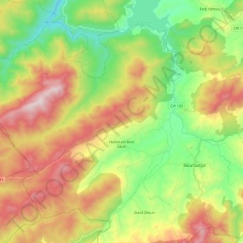
Name: Hammam Beni Salah topographic map, elevation, terrain.
Location: Hammam Beni Salah, Daïra Bouhadjar, El Tarf, Algérie (36.45966 7.85972 36.61349 8.09225)
Average elevation: 1,417 ft
Minimum elevation: 118 ft
Maximum elevation: 3,209 ft
Other topographic maps
Click on a map to view its topography, its elevation and its terrain.
Oued Zitoun
Algérie > El Tarf > Daïra Bouhadjar
Oued Zitoun, Daïra Bouhadjar, El Tarf, Algérie
Average elevation: 2,201 ft