
Oued Zitoun topographic map
Interactive map
Click on the map to display elevation.
About this map
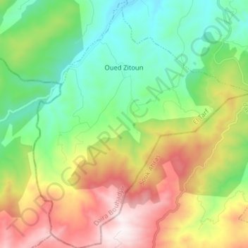
Name: Oued Zitoun topographic map, elevation, terrain.
Location: Oued Zitoun, Daïra Bouhadjar, El Tarf, Algérie (36.39108 8.01059 36.49461 8.12388)
Average elevation: 2,201 ft
Minimum elevation: 820 ft
Maximum elevation: 4,603 ft
Other topographic maps
Click on a map to view its topography, its elevation and its terrain.
Hammam Beni Salah
Algérie > El Tarf > Daïra Bouhadjar
Hammam Beni Salah, Daïra Bouhadjar, El Tarf, Algérie
Average elevation: 1,417 ft