

Barrington topographic map
Click on the map to display elevation.
About this map
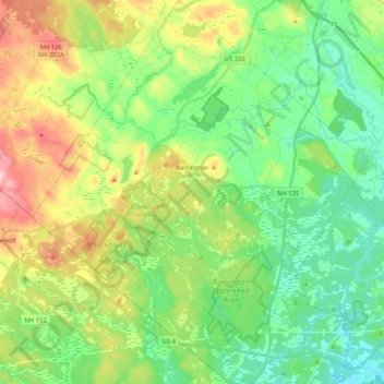
Name: Barrington topographic map, elevation, terrain.
Location: Barrington, Strafford County, New Hampshire, United States (43.13795 -71.13312 43.28858 -70.95281)
Average elevation: 305 ft
Minimum elevation: 49 ft
Maximum elevation: 820 ft
Strafford County trails, hiking, mountain biking, running and outdoor activities
Other topographic maps
Click on a map to view its topography, its elevation and its terrain.


Center Strafford
United States > New Hampshire > Strafford County > Strafford
Average elevation: 486 ft

New Durham Corner
United States > New Hampshire > Strafford County > New Durham
Average elevation: 604 ft

Bow Lake Village
United States > New Hampshire > Strafford County > Strafford
Average elevation: 571 ft

Blue Job Mountain
United States > New Hampshire > Strafford County > Farmington
Average elevation: 899 ft


