Geolocate

Damdim topographic map

Click on the map to display elevation.

Damdim

Dam Dim is located at 26°51′56″N 88°40′11″E / 26.8656°N 88.6698°E / 26.8656; 88.6698 at an elevation of 141 m above MSL.

Wikipedia (CC-BY-SA 3.0)

About this map

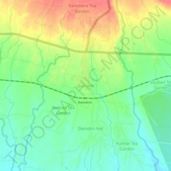
Name: Damdim topographic map, elevation, terrain.

Location: Damdim, Mal, Jalpaiguri District, West Bengal, 735209, India (26.84182 88.65047 26.88182 88.69047)

Average elevation: 528 ft

Minimum elevation: 443 ft

Maximum elevation: 640 ft

Gear up for your next adventure:

⛑️Personal Locator Beacon - Safety beacon for emergencies
🏔️Mountain Trail Maps - High‑detail maps for popular peaks
🩳Quick‑Dry Hiking Shorts - Comfortable and quick‑dry shorts for summer hiking
🎒Day Hiking Backpack - Lightweight backpack perfect for day trips and outdoor adventures
📱Solar Portable Charger - Solar power bank for charging devices off‑grid

As an Amazon Associate, this site earns from qualifying purchases at no extra cost to you.