
Thank you for supporting this site ❤️
Make a donation
Make a donation
Gear up for your next adventure:
As an Amazon Associate, this site earns from qualifying purchases at no extra cost to you.
Nanjri topographic map
Click on the map to display elevation.
Thank you for supporting this site ❤️
Make a donation
Make a donation
Gear up for your next adventure:
As an Amazon Associate, this site earns from qualifying purchases at no extra cost to you.
About this map
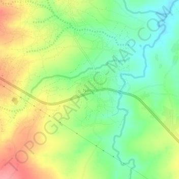
Name: Nanjri topographic map, elevation, terrain.
Location: Nanjri, Lilongwe, Central Region, Malawi, Malawi (-14.09183 33.81473 -14.05183 33.85473)
Average elevation: 3,537 ft
Minimum elevation: 3,402 ft
Maximum elevation: 3,704 ft
Thank you for supporting this site ❤️
Make a donation
Make a donation
Gear up for your next adventure:
As an Amazon Associate, this site earns from qualifying purchases at no extra cost to you.