
Thank you for supporting this site ❤️
Make a donation
Make a donation
Gear up for your next adventure:
As an Amazon Associate, this site earns from qualifying purchases at no extra cost to you.
Pinnow topographic map
Click on the map to display elevation.
Thank you for supporting this site ❤️
Make a donation
Make a donation
Gear up for your next adventure:
As an Amazon Associate, this site earns from qualifying purchases at no extra cost to you.
About this map
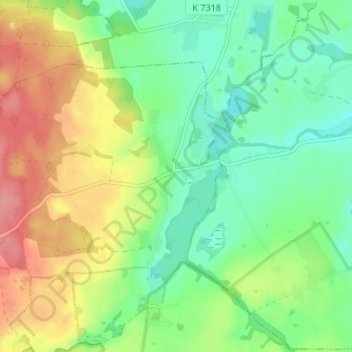
Name: Pinnow topographic map, elevation, terrain.
Location: Pinnow, Gerswalde, Uckermark, Brandenburg, Deutschland (53.19392 13.76757 53.23392 13.80757)
Average elevation: 197 ft
Minimum elevation: 89 ft
Maximum elevation: 361 ft
Thank you for supporting this site ❤️
Make a donation
Make a donation
Gear up for your next adventure:
As an Amazon Associate, this site earns from qualifying purchases at no extra cost to you.