Geolocate

Mount Gilead topographic map

Click on the map to display elevation.

About this map
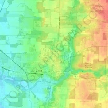
Name: Mount Gilead topographic map, elevation, terrain.

Location: Mount Gilead, Gilead Township, Morrow County, Ohio, 43338, United States (40.53678 -82.85915 40.57567 -82.80102)

Average elevation: 1,135 ft

Minimum elevation: 1,050 ft

Maximum elevation: 1,237 ft

Morrow County trails, hiking, mountain biking, running and outdoor activities

Other topographic maps

Click on a map to view its topography, its elevation and its terrain.

Iberia

United States > Ohio > Morrow County

Average elevation: 1,102 ft

South Woodbury

United States > Ohio > Morrow County

Average elevation: 1,047 ft

Gear up for your next adventure:

🏔️Mountain Trail Maps - High‑detail maps for popular peaks
🌐World Map Poster - Decorative world maps with topographic info
🪄Magnetic Compass - Accurate compass for navigation
🧣Hiking Neck Gaiter - Multi‑use neck protection for outdoor weather
🏕️Family Camping Gear - Essentials for group camping trips

As an Amazon Associate, this site earns from qualifying purchases at no extra cost to you.